

Preparation
In addition to manual flight, the MikroKopter can also automatically fly waypoints. Routes or individual points can be planned in advance in the office and stored into a misson plan. Based on these waypoints the MikroKopter can map a terrain, take panoramic views, panoramas or record automatically thermal images of buildings and solar panels.
Each waypoint flight can be saved and used on the planned area or anywhere else. This is needed for recurring maneuvers (eg for maintenance) where a flight plan can be used in a different area.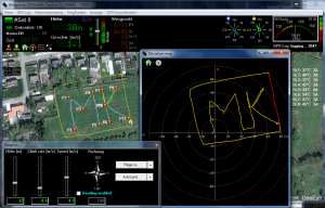
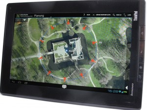
These flights can be prepared very comfortable on a PC or laptop with the MikroKopter tool or on the tablet with our Android MikroKopter software.
3-Dimensional waypoint control with a tablet computer:
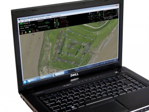
Waypoint-Flight around a small curch: